Reading time: minute(s)
 Deutsch
 English
 Français
Calculate alternative routes
Once you have entered the stations and defined the settings, start route planning by clicking <Calculate> or F9. The best route for the selected settings is then calculated.
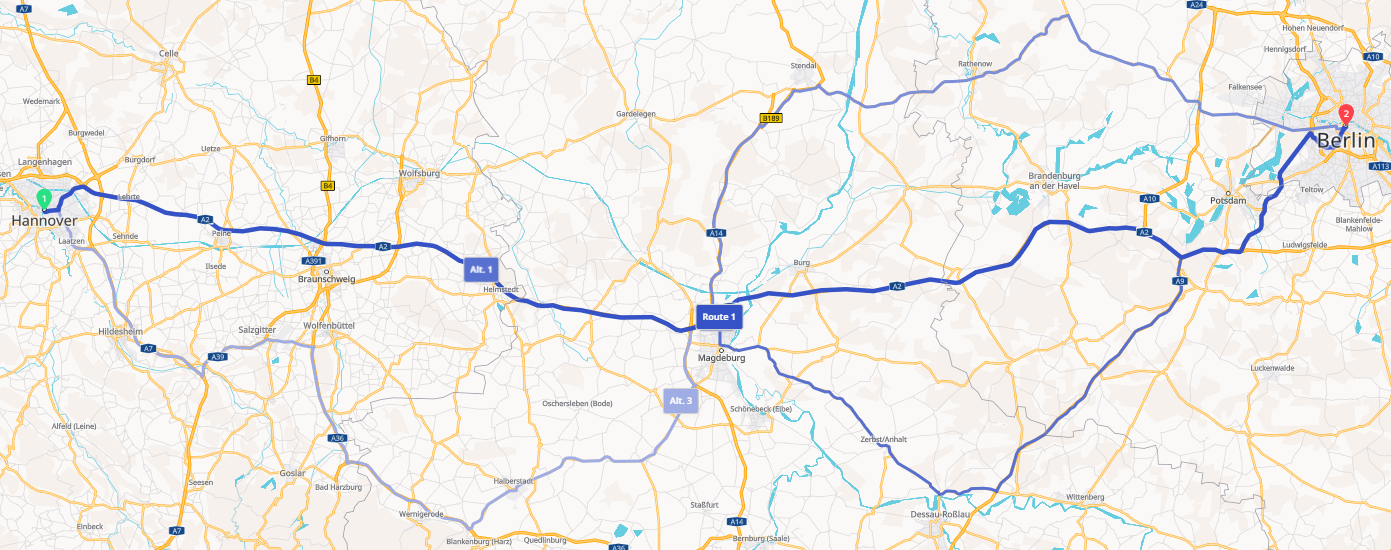
For routes with only two stops (start and destination), you also have the option of calculating alternative route suggestions. The identical settings (vehicle, cost profile, routing settings) are used. The route is routed via other roads (e.g. country road instead of motorway, road with different traffic load, toll-free routes). You can then select the route you require from the resulting alternatives.
Notes: Please note the following:
-
Up to three alternative routes can be calculated.
-
The calculation of alternative routes
-
is only available for routes with two stops (start and destination). If your route contains waypoint stops, the calculation of alternative routes is not available!
-
is not available if a second route has already been created parallel to the first route.
-
is available both in standard mode and in dynamic mode.
-
Attention: The calculation of alternative routes should not be confused with the comparison of two routes. Alternative routes are identical in their stops and settings, whereas all parameters (stops, vehicle, cost profile, routing settings) can be different when comparing routes.
Proceed as follows to calculate alternative routes:
|
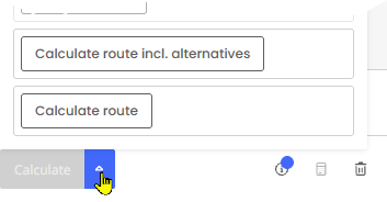
|
The map view now shows the visualization of the route and its alternatives.
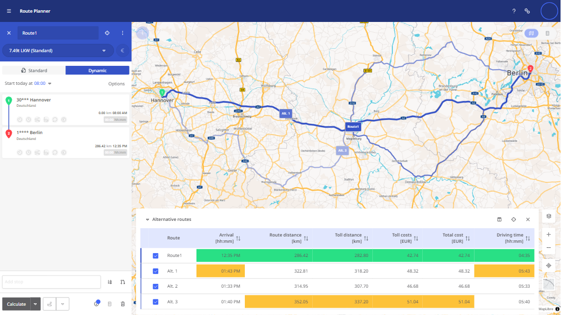
The route and alternatives are listed in tabular form in the lower section of the map. The  button takes you to the column configuration. Using the column selection (incl. drop-down button) above the table, you can customize the display of the columns according to your needs (add or remove). This setting is saved in the user profile.
In each column, the most favorable and least favorable route for this criterion is highlighted in color:
-
the most advantageous route is highlighted in green
-
the most disadvantageous route is highlighted in orange
You can use this color coding to decide which of the alternative routes is most advantageous for you.
Example: In the example above, the main route is the most advantageous in all categories. Alternative route 1 has the longest driving time, which is why the Arrival and Driving time columns are marked in orange. However, compared to alternative route 3, it has a shorter route and generates lower costs.
You have the following options in the table:
-
You can sort the table by any of the configured columns.
-
You can change the order of the columns using drag & drop.
-
You can show or hide a route in the map view using the respective checkbox
-
If you move the pointer over one of the rows, two
 buttons appear on the right
-
Apply route - The selected route/alternative route is defined as the desired route, calculated and displayed with details.
-
Highlight route - The selected route/alternative route is highlighted as glowing on the map view for a few seconds.
-
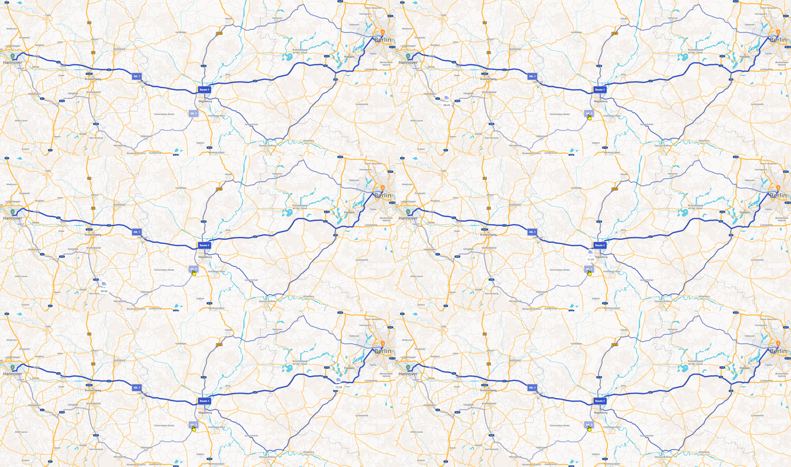
If you click on one of the lines, the route is displayed with an animated vehicle symbol. This is helpful if the different alternative routes partially overlap. This animation is also displayed when you click on the label of the respective route/alternative route on the map. To illustrate this, simply click on the image at the beginning of this chapter.
-
Now select the desired route from the alternatives. To do this, click on the "Apply route" button in the corresponding row.
This route is now displayed as a calculated route on the map with the details area on the right. The other alternatives have been discarded.